Elevate Your Project with Advanced Drone Surveying
The Cutting Edge of Drone Surveying Technology by Matrix Advanced Surveying
Matrix Advanced Surveying’s drone survey services, where we harness the power of Unmanned Aerial Vehicles (UAVs) to deliver unparalleled data accuracy and visual insights. Our UAV drone surveys cater to many industries, providing cost-effective, safe, and efficient solutions for your surveying needs.
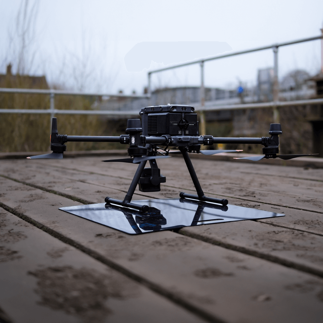
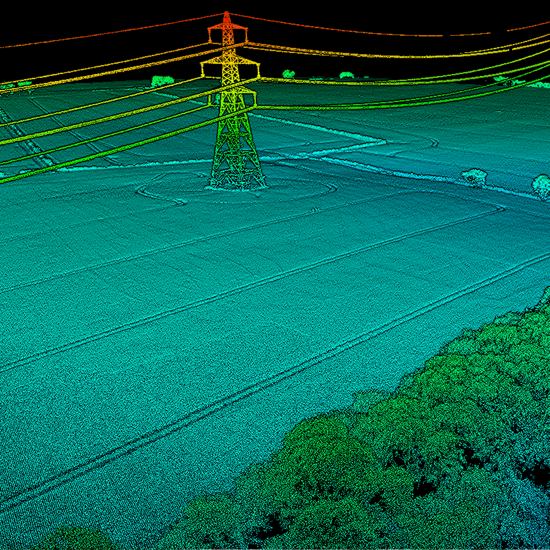
UAV TECHNOLOGY
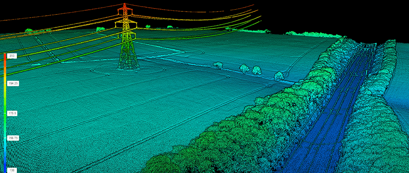
We utilise the latest in drone technology with capabilities for high-resolution photogrammetry, LiDAR, and multispectral imaging.
ADVANCED PROCESSING
Our post-processing software turns raw data into actionable insights, from orthomosaics to digital elevation models.
Real-Time Kinematic (RTK)
For improved positional accuracy in our surveys, ensuring your drone land survey is as precise as possible.
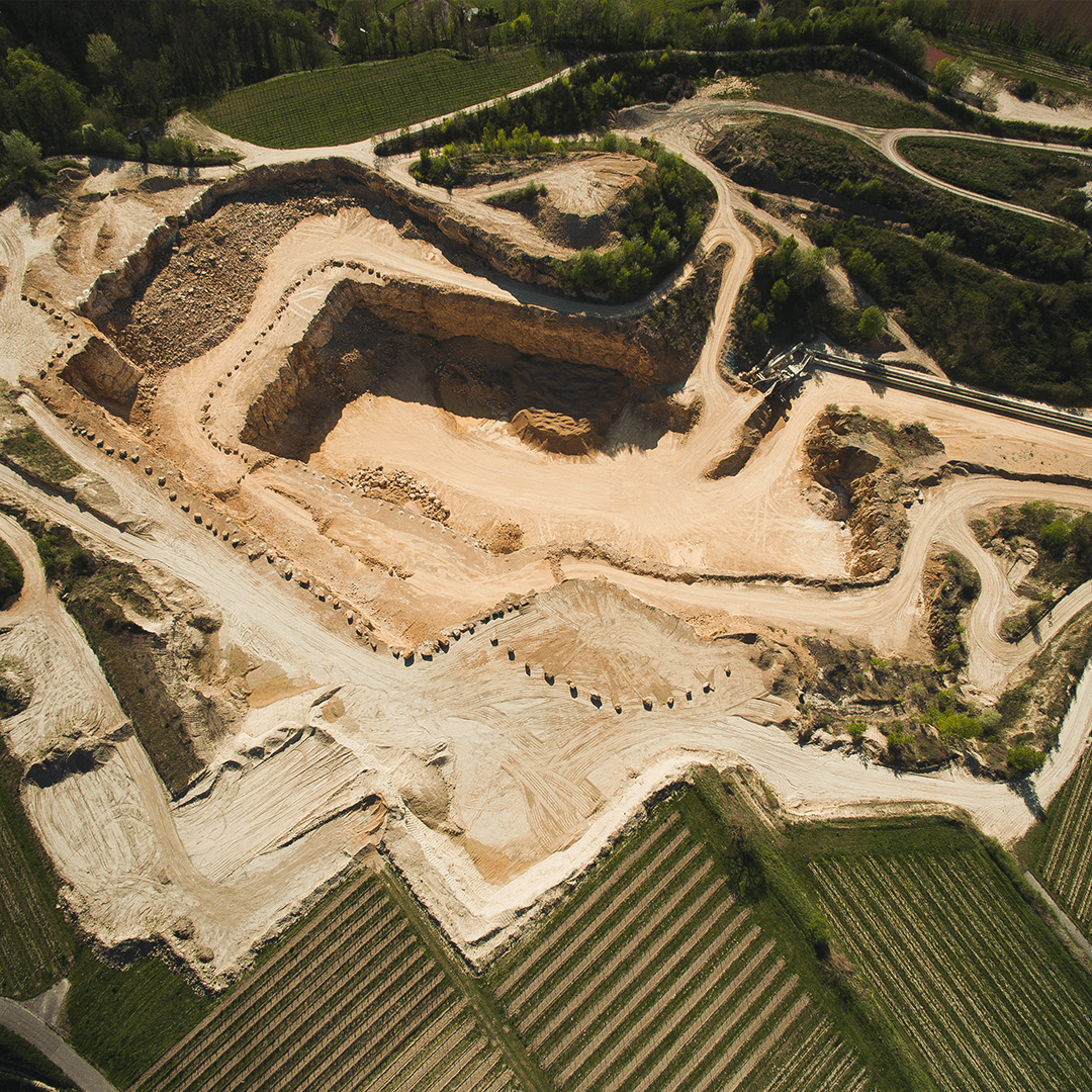
Comprehensive Drone Surveying Solutions
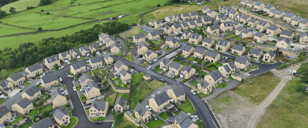
Drone Land Survey
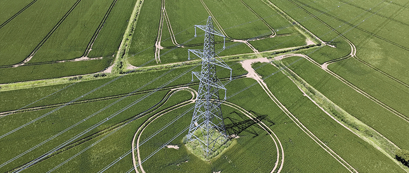
Perfect for large-scale mapping, our drone land survey services provide high-resolution imagery and topographical data, essential for land development, agriculture, and environmental monitoring.
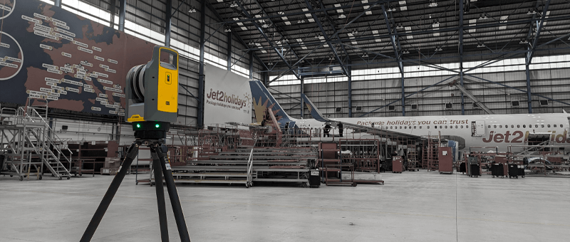
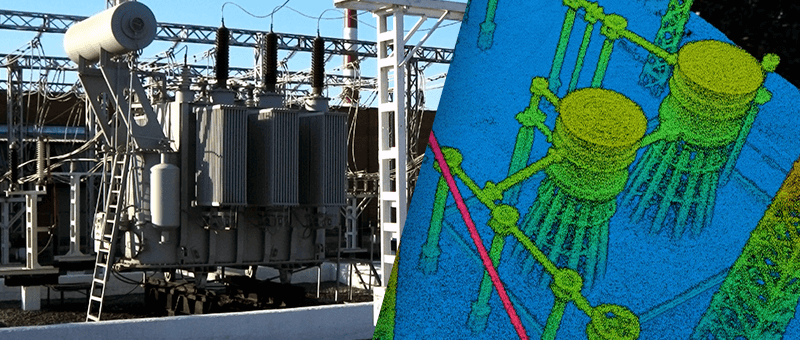
Drone Inspection
Conduct drone inspections for infrastructure, buildings, or hard-to-reach areas, reducing risk and enhancing inspection accuracy with detailed visual and thermal imaging.
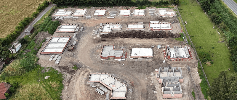
Construction Progress Monitoring
Use our UAV drone survey capabilities to track construction milestones, manage site logistics, and verify work against plans.
Environmental Monitoring
Leverage drone surveys for wildlife tracking, habitat analysis, and environmental impact studies without disturbing the natural setting.
Agricultural Analysis
Enhance crop health, soil analysis, and yield predictions with multispectral drone imagery.
Emergency Response
Rapid deployment for disaster assessment, providing real-time data to guide recovery and planning efforts.
Why Matrix Advanced Surveying are your best solution for Drone Surveying
At Matrix Advanced Surveying, we combine cutting-edge technology with in-depth industry expertise to deliver precise, actionable results for your projects. With our multidisciplinary team of surveyors and in-house civil and structural engineers, we offer seamless end-to-end solutions—from data collection to implementation.
Whether you’re in agriculture, construction, or any sector requiring detailed land analysis, we ensure that every project is completed with efficiency, accuracy, and innovation. Trust us to provide the insights and expertise needed to drive your success.
Seamless Integration from Data to Action
I am item content. Click edit button to change this text. Lorem ipsum dolor sit amet, consectetur adipiscing elit. Ut elit tellus, luctus nec ullamcorper mattis, pulvinar dapibus leo.
Accordion #2
I am item content. Click edit button to change this text. Lorem ipsum dolor sit amet, consectetur adipiscing elit. Ut elit tellus, luctus nec ullamcorper mattis, pulvinar dapibus leo.
Accordion #3
I am item content. Click edit button to change this text. Lorem ipsum dolor sit amet, consectetur adipiscing elit. Ut elit tellus, luctus nec ullamcorper mattis, pulvinar dapibus leo.
READY TO START
YOUR NEW PROJECT?
Please fill in the form and we will get back to you as soon as possible to discuss your new project.