


The world of surveying is on the cusp of a technological revolution, and Matrix Advanced Solutions is at the forefront of this transformation. With an unwavering commitment to precision, sustainability, and innovation, Matrix is redefining how land, aerial, and environmental data is collected, processed, and applied across industries.
As challenges like urbanisation, climate change, and infrastructure demands grow, the role of surveying has never been more critical. Here’s how Matrix Advanced Solutions is shaping the future of this vital industry.
A Vision of Innovation
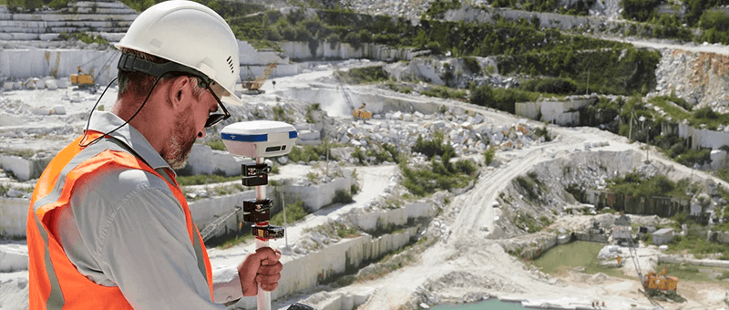
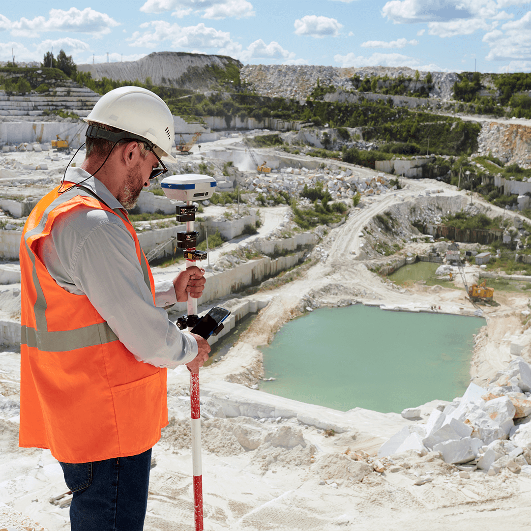
Surveying has evolved far beyond tape measures and theodolites. Today, it’s about leveraging cutting-edge technology to deliver actionable insights with speed, accuracy, and sustainability. Matrix Advanced Solutions embodies this modern approach, combining traditional expertise with advanced tools like drones, LiDAR, and GIS to offer unparalleled services.
“Our mission is to not only meet the needs of our clients but also anticipate the demands of tomorrow’s world,” says [Insert Name], a representative at Matrix Advanced Solutions. “From renewable energy to heritage conservation, we’re paving the way for smarter, greener surveying practices.”
Pioneering Technology in Surveying
Matrix has embraced a suite of innovative technologies that are transforming the surveying landscape. Here’s a closer look at some of the tools and techniques shaping the future:
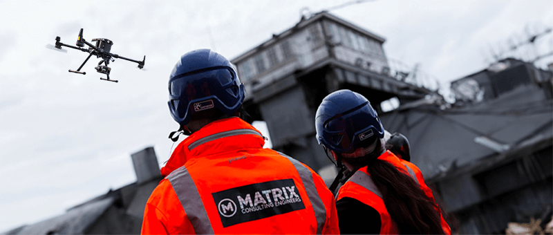
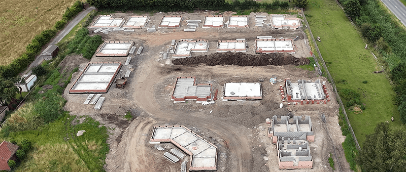
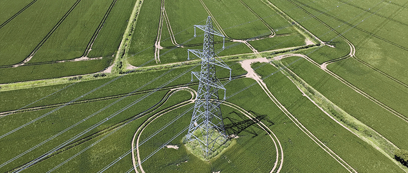
1. Drone Technology: Surveying from New Heights
Unmanned Aerial Vehicles (UAVs) have revolutionised data collection by offering high-resolution imagery and detailed topographical data from above.
- Applications: Used in infrastructure inspections, agricultural surveys, and disaster response.
- Benefits: Drones significantly reduce time and costs while improving safety in hazardous environments.
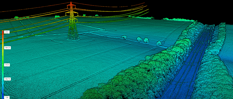
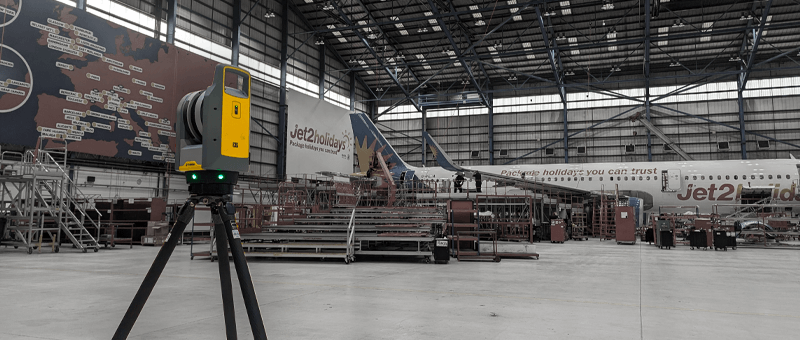
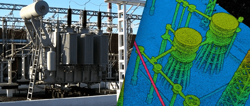
2. LiDAR: Precision in Every Pulse
LiDAR (Light Detection and Ranging) is a cornerstone of Matrix’s surveying solutions, enabling the creation of 3D maps with unparalleled detail.
- Applications: From forest mapping to urban planning, LiDAR provides precise data for even the most complex terrains.
- Future Prospects: Advances in LiDAR technology are expected to make it even more portable, cost-effective, and versatile.
3. GIS Integration: Smarter Data Management
Geographic Information Systems (GIS) allow surveyors to visualise, analyse, and interpret spatial data.
- Matrix’s Edge: By integrating GIS with real-time drone and LiDAR data, Matrix offers clients a comprehensive view of their projects, aiding decision-making.
4. Sustainability-Driven Solutions
Matrix incorporates sustainable practices by minimising environmental disruption and reducing carbon footprints.
- Examples: Using drones for surveys reduces the need for fuel-heavy machinery and large teams on-site, promoting eco-friendly operations.
Sector-Specific Innovations
Matrix Advanced Solutions’ expertise spans multiple sectors, each with unique challenges and opportunities:
Renewable Energy
Matrix plays a vital role in supporting the shift to renewable energy through innovative surveying for wind farms, solar installations, and hydroelectric projects.
- Impact: Site selection, maintenance planning, and efficiency optimisation are conducted with minimal environmental disruption.
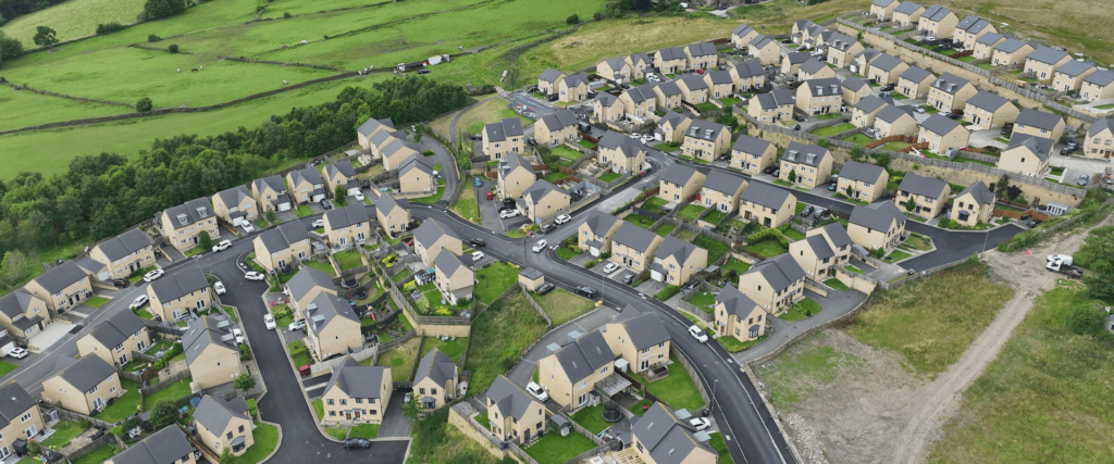
Urban Infrastructure
With cities expanding at unprecedented rates, urban infrastructure requires precision planning.
- Matrix’s Contribution: Advanced 3D mapping and topographical surveys aid in the development of smart cities, ensuring sustainability and resilience.
Heritage Conservation
Preserving historical sites requires meticulous planning and non-invasive methods.
- Matrix’s Approach: The company’s use of 3D laser scanning and point cloud surveys ensures historical accuracy while protecting fragile sites.
Agriculture
Precision agriculture is another area where Matrix is making a significant impact.
- Technological Integration: Drone surveys and soil mapping help farmers maximise yields while conserving resources.
Adapting to Global Challenges
Matrix’s forward-thinking approach positions it as a leader in tackling global challenges through surveying.
- Climate Change: As rising sea levels and extreme weather events reshape landscapes, Matrix uses LiDAR and drone surveys to monitor changes and inform mitigation strategies.
- Disaster Response: During emergencies, Matrix’s drones provide real-time data for search and rescue operations, ensuring faster and safer outcomes.
- Sustainability Goals: By adopting low-impact technologies, Matrix aligns its operations with the United Nations’ Sustainable Development Goals (SDGs).
The Human Element: Expertise Meets Innovation
While technology drives the future of surveying, Matrix understands that human expertise remains irreplaceable. The company’s multidisciplinary team of surveyors, engineers, and technologists ensures that every project benefits from a blend of technical acumen and creative problem-solving.
“Our team isn’t just using tools; we’re innovating with them,” says [Insert Name]. “It’s about applying technology in ways that deliver real-world results for our clients.”
Looking Ahead: The Future of Surveying
The surveying industry is poised for exponential growth as technologies like Artificial Intelligence (AI), augmented reality (AR), and quantum computing become more integrated into workflows. Here’s what the future holds:
AI and Machine Learning
- Predictive Analysis: AI will analyse trends in data, enabling proactive decision-making.
- Automation: Machine learning will automate repetitive tasks, freeing surveyors to focus on complex challenges.
Augmented and Virtual Reality
- Interactive Models: Clients and stakeholders will be able to visualise projects in AR/VR environments, enhancing collaboration and planning.
Quantum Computing
- Unparalleled Processing Power: Quantum systems will handle complex data sets faster, opening new possibilities for surveying large or intricate sites.
Matrix Advanced Solutions is already preparing for these advancements, ensuring it remains at the cutting edge of the industry.
Conclusion
Surveying is no longer confined to measuring land—it’s about shaping the future. By embracing technology, sustainability, and a client-focused approach, Matrix Advanced Solutions is redefining what’s possible in the industry. Whether it’s building smarter cities, conserving historical landmarks, or supporting renewable energy, Matrix is not just meeting the challenges of today but anticipating the needs of tomorrow.
With its innovative mindset and commitment to excellence, Matrix Advanced Solutions is not just shaping the future of surveying—it’s shaping the future itself.